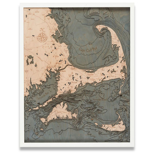
Cape Cod - Small
Cape Cod is found on the southeastern corner of the Massachusetts mainland. It extends into the Atlantic Ocean and is a popular tourist destination in the summer months due to its historic charm, maritime character, and the abundance of beautiful beaches. The Cape Cod Canal, which runs roughly 17.5 miles long, separates the mainland from the cape and has two primary highway bridges, the Sagamore and Bourne Bridges, that cross over the canal. The cape territory is divided into several villages and a total of 15 towns and includes a railway freight that provides a limited amount of service to passengers. Cape Cod runs outward 65 miles into the Atlantic Ocean with over 400 miles of shoreline; Pine Hill is the cape’s highest point with Joint Base Cape Cod in the Bourne area reverting to sea level. With being one of the largest barrier islands in the world, and with the cape itself acting as a shield, it’s no wonder that this area is protected from the towns of Fairhaven to Marshfield and from erosion by way of the North Atlantic storm waves.
- Agawam River
- Ashumet Pond
- Aucoot Cove
- Barnstable
- Barnstable Harbor
- Bearse Shoal
- Billingsgate Shoal
- Bourne
- Brewster
- Brook Street
- Buzzards Bay
- Cape Cod Canal
- Cape Cod National Seashore
- Carver
- Carver Road
- Cataumet
- Center Hill Point
- Centerville
- Centerville Harbor
- Chatham
- Chatham Roads
- Childs River
- Clarks Island
- Cliff Pond
- Cotuit
- County Road
- CQX Airport
- Dead Neck
- Dennis
- Dogfish Bar
- Duxbury
- Duxbury Bay
- Duxbury Beach
- East Dennis
- East Falmouth
- East Harwich
- East Sandwich
- Eastham
- Eldridge Shoal
- Falmouth
- Falmouth Harbor
- Falmouth Road
- FMH Airport
- Forestdale
- Great Island
- Great Marshes
- Great South Pond
- Gurnet Point
- Halfway Pond
- Handkerchief Shoal
- Harlow Brook
- Harwich
- Harwich Port
- Hog Island
- Horseshoe Shoal
- HYA Airport
- Hyannis
- Hyannis Harbor
- Kill Pond Bar
- Kingston
- Kingston Bay
- Lewis Bay
- L'Hommedeiu Shoal
- Little Round Shoal
- Long Pond
- Long Pond Road
- Lookout Point
- Main Street
- Manomet
- Marion
- Marshfield
- Marstons Mills
- Mashpee
- Mashpee River
- Mattapoisett
- Mattapoisett Harbor
- Mid-cape Highway
- Mill Pond
- Monomoy Islands
- Monomoy Shoals
- Monument Beach
- Myles Standish State Forest
- Nasketucket Bay
- Nauset Beach
- Naushon Island
- New Seabury
- North Atlantic Ocean
- North Channel
- North Eastham
- North Falmouth
- North Plymouth
- North Street
- Onset
- Orleans
- Osterville
- Peaked Hill Bar
- Pembrooke
- Pleasant Bay
- Plymouth
- Plymouth Bay
- Plymouth Beach
- Plympton
- Pocasset
- Pollock Rip Channel
- Provincetown
- Provincetown Harbor
- PVC Airport
- Quashnet River
- Race Point Beach
- Rochester
- Rock Harbor Creek
- Rocky Point
- Rodgers Shoal
- Sagamore Beach
- Sandwich
- Sandwich Harbor
- Sandy Neck
- School Street
- Scorton Creek
- Scraggy Neck
- Silver Lake
- Sippican Harbor
- South Dennis
- South Duxbury
- South Pond Road
- South Yarmouth
- State Road
- Stone Horse Shoal
- Stony Point Dike
- Strong Island
- Succonnesset Shoal
- Summer Street
- Teaticket
- Tremont Street
- Truro
- Wakeby Pond
- Wapping Road
- Wareham
- Wareham River
- Warren Cove
- Weepicket Islands
- Wellfleet
- Wellfleet Harbor
- West Barnstable
- West Dennis
- West Falmouth
- West Island
- Wings Cove
- Wings Neck
- Woods Hole
- Wreck Shoal
- Yarmouth


