Cape May
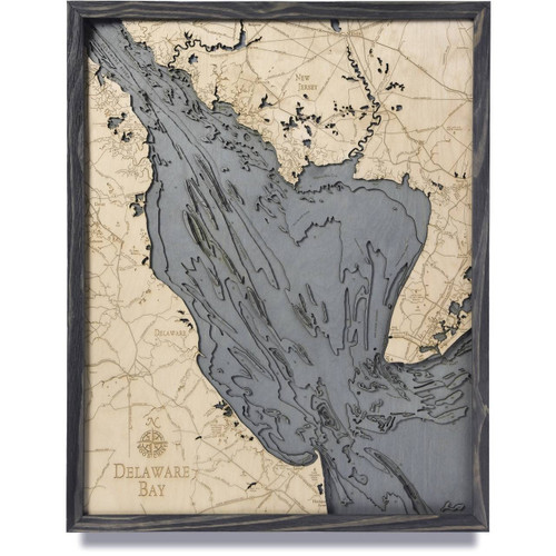
Off the southernmost point of New Jersey is the island and peninsula of Cape May, which runs from the state’s mainland, the Atlantic Ocean, and the Delaware Bay. Home to the oldest seaside resort in America, with pristinely maintained original Victorian buildings, this area has a history that dates back as far as the 18th century and the city itself has been named a National Historical Landmark. The main municipalities within the peninsula include Middle Township, Avalon, Dennis Township, Stone Harbor, North Wildwood, West Wildwood, Wildwood, Lower Township, Wildwood Crest, North Cape May, West Cape May, Cape May, and Cape May Point. This region of New Jersey has numerous nature preserves and wildlife refuges and is well known as one of the country’s top birding sites, especially during the spring and fall migration, and includes such organizations as the Cape May Bird Observatory and the World Series of Birding which takes place every May.
- 4th Ave.
- Academy Road
- Arcus Road
- Bay Shore Channel
- Bayshore Road
- Bayview Ave.
- Beach Ave.
- Beach Drive
- Bennett Creek
- Broadway
- Bunker
- Cape Island Creek
- Cape May
- Cape May Ave.
- Cape May Canal
- Cape May Channel
- Cape May Harbor
- Cape May Inlet
- Cape May Point
- Cold Spring
- Daveys Lake
- Diamond Beach
- Elderedge Ave.
- EPH Shoal
- Fire Lane
- Fishing Creek Road
- Fraser Ave.
- Garden State Parkway
- Higbee Beach
- Jarvis Sound
- Jonathan Hoffman Road
- Lake Lily
- Layfette Street
- Leaming Ave.
- Lower Thorofare
- Madison Ave.
- Middle Thorofare
- Mill Creek
- Missouri Ave.
- Munro Ave.
- New England Road
- North Atlantic Ocean
- North Cape May
- North Shoal
- Ocean Drive
- Old Lower Thorofare
- Pacific Ave.
- Park Blvd.
- Pennsylvania Ave.
- Pittsburgh Ave.
- Pond Creek
- Prissy Wicks Shoal
- Punyard Point
- Reubens Thorofare
- Rose Hill Parkway
- Scott Ave.
- Seagrove Ave.
- Seashore Road
- Sewell Point
- Shell Thorofare
- Shunpike Road
- Sixth Ave.
- Skunk Sound
- Southwest Cove
- Stevens Street
- Sunset Beach
- Sunset Blvd.
- Swain Channel
- Thorofare Island
- Town Bank Road
- Two Mile Beach
- USCG Entrance Street
- USCG Training Center
- Virginia Ave.
- West Cape May
- Whittier Ave.


