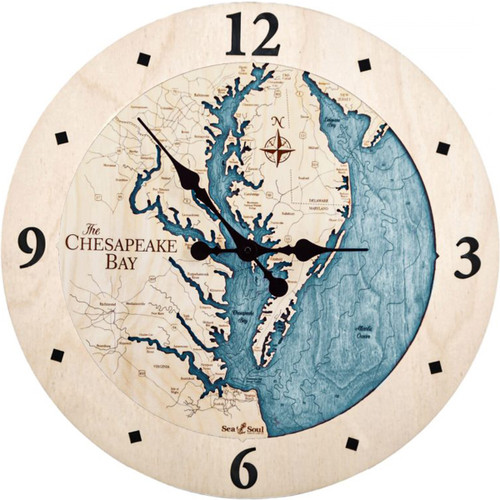
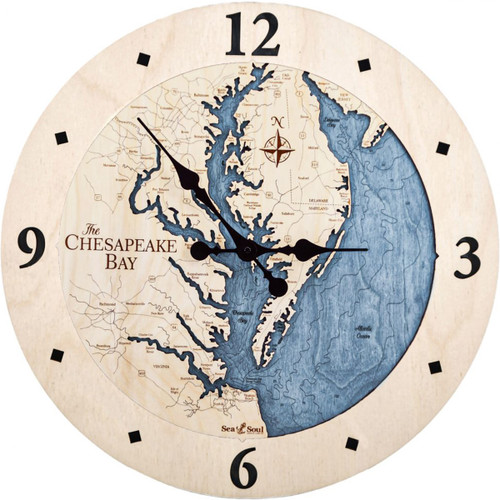
Chesapeake Bay Tray
Lying inland from the Atlantic Ocean, Chesapeake Bay is North America’s largest estuary, with the northern portion starting in the state of Maryland and the southern region reaching down past Virginia. Features of the Chesapeake Bay include more than 150 major rivers and streams, all of which flow into the bay’s massive drainage basin of 64,299 square miles. The drainage basin itself covers parts of six US states. Aside from Maryland and Virginia, it also includes New York, Pennsylvania, Delaware, West Virginia and the entirety of Washington D.C.
- Aberdeen
- Alexandria
- Anacostia River
- Anapolis
- Annemessex River
- Aquia Creek
- Arlington
- Aspen Hill
- Back River
- Baltimore
- Battle Creek
- Beasley Bay
- Bethesda
- Bird River
- Bishops Head
- Blackwater River
- Bloodsworth Island
- Blue Star Memorial Highway
- Bohemia River
- Breton Bay
- Bridgeville
- Budds Creek Road
- Burke
- Burke Lake
- Bush River
- Cambridge
- Chaptico Bay
- Chesapeake and Delaware Canal
- Chester Bay
- Chester River
- Choptan River
- Coaches Island
- Cobb Island
- Colonial Beach
- Columbia
- Cordova
- Corrotoman River
- Corsica River
- Crisfield
- Crofton
- Curtis Bay
- Deal Island
- Delaware
- Delaware City
- Denton
- Dover
- Dundalk
- E. Neck Island
- Eastern Bay
- Easton
- Edgewood
- Elk Neck
- Elk River
- Fairlee Creek
- Federalsburg
- Fishing Bay
- Fishing Creek
- Fort Washington
- Fredericksburg
- Frenchtown
- Fruitland
- Gaithersburg
- Galestown
- Glen Burnie
- Gunpowder Neck
- Gunpowder River
- Harrington
- Harris Creek
- Hart Miller Island
- Hawk Cove
- Heathsville
- Herring Bay
- Hobbs
- Holland Straits
- Honga River
- Hooper Islands
- Hughesville
- Island Creek
- Kent Island
- King William
- La Plata
- Lancaster
- Lancaster Creek
- Langford Creek
- Laurel
- Lexington Park
- Liberty Lake
- Little Choptank
- Loch Raven Reserve
- Magothy River
- Manokin River
- Marley Creek
- Maryland
- Mason Neck
- Mattawoman Creek
- McKans Bay
- Middle River
- Middletown
- Milestown
- Monie Bay
- Monocacy River
- Mt. Vernon
- Mt. Victoria
- Nanticoke River
- North Beach
- Notheast River
- Occoquan Bay
- Occoquan Creek
- Occoquan River
- Onancock
- Oxford
- Pappahahnock Shoal Channel
- Patapsco River
- Patuxent River
- Perryville
- Piscataway Creek
- Pocomoke City
- Pooles Island
- Poplar Island
- Port Tobacco River
- Potomac
- Potomac Creek
- Prince Frederick
- Princess Anne
- Quantico
- Queenstown
- Rappahannock River
- Rhode River
- Rock Hall
- Rock Pt.
- Round Bay
- Salem
- Salisbury
- Sassafrass River
- Seaford
- Severn River
- Sillery Bay
- Slaughter Creek
- Smith Island
- Smyrna
- South Marsh Island
- South River
- Spesutie Island
- St. Charles
- St. Clementa Bay
- St. Leonard Creek
- St. Mary's River
- Stevensville
- Still Pond Creek
- Susquehanna River
- Tangier Sound
- Tappahannock
- Tar Bay
- Taylor's Island
- Towson
- Tred Avon River
- Trippe Bay
- Urbanna
- Virginia
- Waldorf
- Warsaw
- Warton Creek
- Washington D.C.
- Watts Island
- West River
- Wicomico River
- Wye Island
- Wye River


