Door County / Green Bay
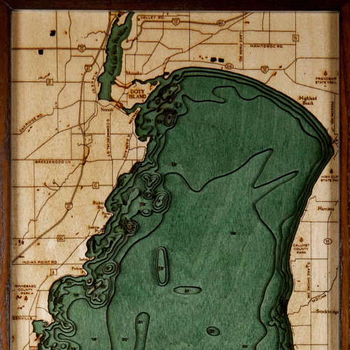
Door county was created in 1851 and organized in 1861. It is named after the strait between the Door Peninsula and Washington Island. The dangerous passage, known as Death's Door, is now scattered with shipwrecks, and was known to early French explorers and local Native Americans. Door County is a popular vacation and tourist destination, dominated by Illinois residents.
- 15th Rd.
- Airport Dr.
- Algoma
- Algoma Rd.
- Allouez
- Anderson Point
- Authur Bay
- Bac Bay
- Baileys Harbor
- Bank River
- Barretts Point
- Bellevue
- Big Bay De Noc
- Cana Cove
- Cave Point
- Cedar River
- Cedar River Rd.
- Chambers Island
- Chippewa Point
- Clark Lake
- Co. Rd. 338
- Co. Rd. 551
- De Pere
- Dead Horse Bay
- Deadmans Point
- Delta County Airport
- Denmark
- Detroit Harbor
- Detroit Island
- Detroit Island Passage
- Duck Creek
- Eagle Harbor
- East River
- Egg Harbor
- Escanaba
- Escanaba River
- Europe Lake
- F Rd.
- Fairport
- Fish Creek
- Fishdam River
- Fisherman Shoal
- Ford River
- Forestville
- Fox River
- Garden Bay
- Garden Creek
- Garden Peninsula
- Gardner Swamp State Wildlife Area
- Garrett Bay
- Gladstone
- Green Bay
- Green Island
- Hat
- Hayward Bay
- Hog Island
- Horseshoe Reefs
- Howard
- II Rd.
- Indian Point
- J. Douglas Bake Memorial Airport
- Jacks Bluff
- Jackson Harbor
- Jasksonport
- Juddville Bay
- Kangaroo Lake
- Kewaunee
- Kewaunee River
- Lake Michigan
- Lilly Bay
- Little Bay De Noc
- Little Fishdam River
- Little Harbor Point
- Little Scarboro State Public Hunting Grounds
- Little Sturgeon Bay
- Little Summer Island
- Long Tail Point
- Luxemburg
- Marinette
- Maywood
- Menominee
- Menominee River
- Michigan
- Middle Bluff
- Mink River
- Moonlight Bay
- Mud Lake State Wildlife Area
- Nahma
- Newport Bay
- Newport State Park
- NF-13
- North Bay
- North County Line Rd.
- Northport
- Oconto
- Ogontz Bay
- Ogontz River
- Oneida
- Pensaukee
- Pensaukee River
- Peshtigo
- Peshtigo Harbor
- Peshtigo Harbor State Wildlife Area
- Piglet Point
- Plum Island
- Porcupine Point
- Portage Bay
- Portage Point
- Porte Des Morts Passage
- Postings Point
- Poverty Island Passage
- Poverty Island Shoal
- Rock Island
- Rock Island Passage
- Rocky Point
- Rowleys Bay
- Sand Bay
- Sand Bay
- Sawyer Harbor
- Sawyer Point
- Shingleton State Forest Area
- Shoemaker Point
- Shore Dr.
- Sister Bay
- Sister Island
- South River Bay
- St. Martin Island
- St. Martin Island Passage
- St. Vital Point
- Sturgeon Bay
- Sturgeon River
- Suamico
- Summer Island
- Toft Point
- Washington Harbor
- Washington Island
- Whaleback Shoal
- Whitefish Bay
- Whitefish River
- Wiggins Point
- Wilbury Bay Point
- Wisconsin


