


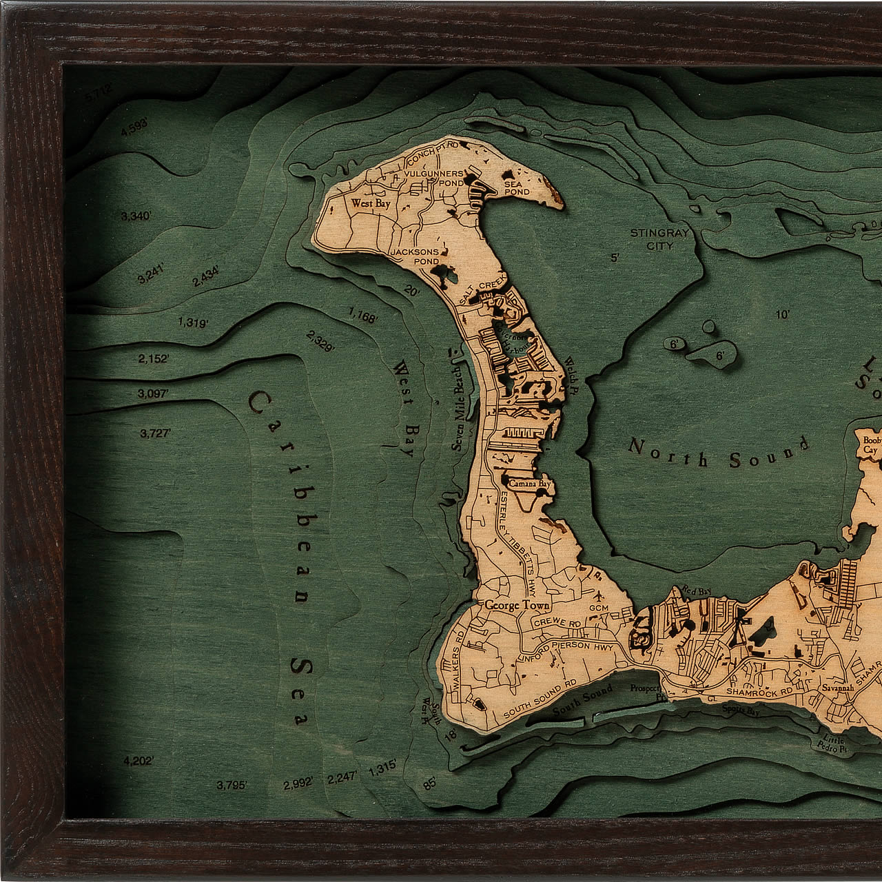
Grand Cayman
- Handmade laser cut 3D topographic wood map
- Materials: High-quality Baltic Birch Wood
- Framed in solid wood, ready to hang
- Protected by acrylic glass
- Depths of ocean/ lake/ river engraved on wood
- Up to 9 layers of depth
- Incredibly detailed with engraved points of interest
The largest of the three Cayman Islands is the Grand Cayman, stretching out 22 miles long and making up 76% of the area’s land mass. The other two islands are Little Cayman and Cayman Brac. Mastic Trail is included in the areas highest point from the beaches, reaching 60 feet above sea level. Bodden Town, East End, George Town, North Side, and West Bay are five of the six districts that make up this tropical area in total. Aside from the many sparkling water beaches, watersports of all sorts are a sought-after attraction in the Grand Cayman. Watersports include scuba diving and snorkeling to catch a view of the vibrant coral reefs, underwater sea walls, and countless number of haunting shipwrecks that lie just below the water's surface.
- Anchor Point
- Austin Conolly Drive
- Beach Bay
- Blue Iguana Nature Reserve
- Bluff Bay
- Bodden Bay
- Bodden Town
- Booby Cay
- Breakers
- Camana Bay
- Caribbean Sea
- Colliers Point
- Colliers Pond
- Conch Point Road
- Crewe Road
- East End
- East End Marshland Habitat
- Esterley Tibbetts Highway
- Farm Road
- Frank Sound
- Frank Sound Road
- GCM Airport
- George Town
- Governors Harbor
- Grand Cayman
- Gun Bay
- High Rock Drive
- Hutland
- Jacksons Pond
- Linford Pierson Highway
- Little Pedro Point
- Little Sound
- Lower Valley
- Malportas Pond
- Meagre Bay Pond
- North Side
- North Side Road
- North Sound
- Old Man Bay
- Old Robin Road
- Pease Bay Pond
- Prospect Point
- Queen Elizabeth II Botanic Park
- Queens Highway
- Red Bay
- Rum Point Drive
- Salina Reserve
- Salt Creek
- Savannah
- Sea Pond
- Sea View Road
- Seven Mile Beach
- Shamrock Road
- South Point
- South Sound Road
- South West Point
- Sparrowhawk Point
- Spotts Bay
- Stingray City
- Vulgunners Pond
- Walkers Road
- Water Cay
- Welch Point
- West Bay


