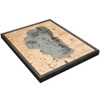
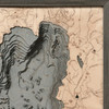
Lake Tahoe - Large
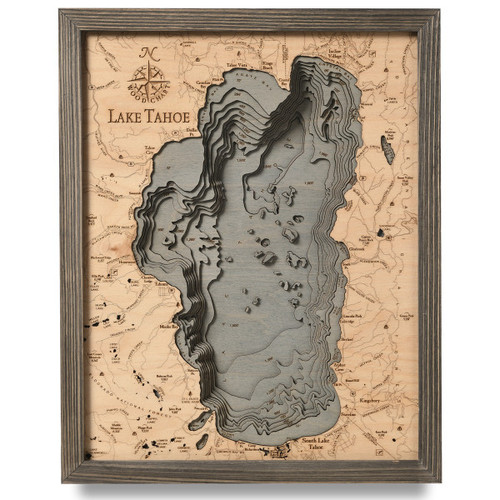
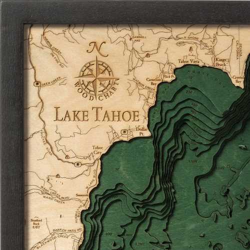
Lake Tahoe is the United States largest freshwater lake in the Sierra Nevada, spanning 6,225 feet between the borders of California and Nevada, and the second deepest after Oregon’s Crater Lake, with depths that reach 1,645 feet. This massive North American alpine lake was first formed 2 million years ago as part of the Lake Tahoe Basin and shaped into its modern state during the ice ages. The crystal-clear waters and panoramic view of the surrounding mountain ranges are what this area is best known for. More than 75 percent of the lake’s watershed is national forest land. This major tourist attraction is not just popular during the summer months, but has visitors flock from all over to the both the California and Nevada regions for its snow and ski resorts, making Lake Tahoe an incredibly scenic and highly enjoyable vacation spot all year round.
- Agate Bay
- Ash Canyon Creek
- Azure Lake
- Baldwin Beach
- Bear Creek
- Blackwood Creek
- Blackwood Ridge
- Bliss Creek
- Brush Creek
- Buck Lake
- Burke Creek
- Burton Creek
- Burton Creek State Park
- Camp Richardson
- Captain Pomin Rock
- Carnelian Bay
- Cascade Creek
- Cascade Lake
- Chambers Lodge
- Clear Creek
- Cold Creek
- Corsser Creek
- Crag Lake
- Crystal Bay
- Daggett Creek
- Deadman Point
- Deep Creek
- Deer Creek
- Desolation Wilderness
- Dicks Lake
- DL Bliss State Park
- Dollar Creek
- Dollar Point
- Duane Bliss Peak
- Duck Lake
- Eagle Lake
- Eagle Point
- East Peak
- East Peak Lake
- Edgewood Creek
- Eldorado National Forest
- Elk Point
- Ellis Lake
- Ellis Peak
- Emerald Bay
- Emerald Point
- Fallen Leaf Lake
- Fannette Island
- First Creek
- Flick Point
- Fontanillis Lake
- Franktown Creek
- General Creek
- Glenbrook Bay
- Glenbrook Creek
- Granite Lake
- Griff Creek
- Heavenly Valley Creek
- Herlan Peak
- Hobart Creek Reservoir
- Homewood
- Idlewild
- Incline Creek
- Incline Village
- Jakes Peak
- Kings Beach
- Kingsbury
- Lake Lois
- Lake Louise
- Lakeridge
- Lake Schmidell
- Lake Tahoe Nevada State Park
- Lake Valley
- Lily Lake
- Lincoln Park
- Logan House Creek
- Logan Shoals
- Lost Corner Mountain
- Lost Lake
- Lower Velma Lake
- Madden Creek
- Marla Bay
- Marlette Creek
- Marlette Lake
- Marlette Peak
- Martis Creek
- McFaul Creek
- McKinney Bay
- McKinney Creek
- McKinney Lake
- Meeks Bay
- Meeks Creek
- Memorial Point
- Middle Mountain
- Middle Velma Lake
- Mill Creek
- Miller Lake
- Monument Creek
- Monument Peak
- Mount Tallac
- Mount Watson
- North Canyon Creek
- Phipps Creek
- Phipps Lake
- Pole Creek
- Quail Lake
- Rampart
- Richardson Lake
- Round Hill
- Rubicon Bay
- Rubicon Peak
- Rubicon Point
- Rubicon Reservoir
- Rubicon River
- Sand Harbor
- Sand Point
- Sawmill Lake
- Second Creek
- Secret Harbor
- Skunk Harbor
- Skyland
- Snow Lake
- Snow Valley Peak
- South Fork Daggett Creek
- South Lake Tahoe
- South Point
- Spooner Lake
- Squaw Creek
- Stanford Rock
- Stony Ridge
- Tahoe City
- Tahoe National Forest
- Tahoe Pines
- Tahoe Vista
- Tahoma
- Tallac Creek
- Tallac Point
- Taylor Creek
- Third Creek
- Toiyabe National Forest
- Trout Creek
- Truckee River
- Tunnel Creek
- Twin Lakes
- Ward Creek
- Watson Creek
- Watson Lake
- Zephyr Cove


