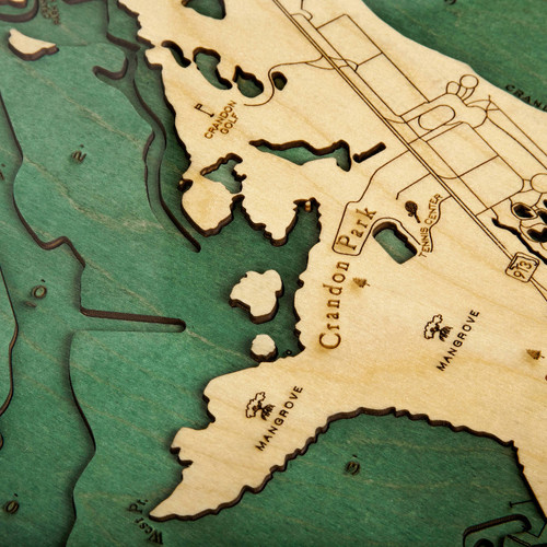
Lower Florida Keys
A coral cay archipelago just off the southern coast of Florida, the Florida Keys form the southernmost region of the continental US, beginning at the Florida peninsula on southeastern coast (just 15 miles south of Miami) and then arching into Key West—the westernmost region of islands—with the uninhabited Dry Tortugas lying just beyond that. Key West’s southern point lies just 90 miles from Cuba, with the islands of the Florida Straits dividing the Gulf of Mexico from the Atlantic Ocean and defining the Florida Bay. The climate of the Keys is best described as the tropical savanna with a total land area of 137.3 square miles. The Seven Mile Bridge, one of the longest bridges when it was first built (6.79 miles long), is what connects Knight's Key to Little Duck Key, while it completely bypasses Pigeon Key. The original structure of the bridge included an access point to Pigeon Key but was closed to vehicular traffic in 2008 because of structure aging. The roadway, US Highway 1 is now referred to as the Overseas Highway and is the chief means for automobile travel from Key Largo all the way south to Key West and throughout the tropical islands that make up the Florida Keys.
- Annette Key
- Anonimo Key
- Barracuda Keys
- Barracuda Keys Channel
- Bay Keys
- Big Coppitt Key
- Big Harper Key
- Big Mangrove Key
- Big Pine Key
- Big Pine Shoal
- Big Spanish Channel
- Big Torch Key
- Bill Finds Key
- Bird Key
- Bluefish Channel
- Boca Chica Key
- Boco Chica Channel
- Boco Chica Rd.
- Bogie Channel
- Bow Channel
- Budd Keys
- Calda Bank
- Calda Channel
- Cayo Agua
- Channel Key
- Cooks
- Coon Key
- Coupon Bight
- Cow Key
- Crab Key
- Crane Keys
- Crawl Key
- Cudjoe Basin
- Cudjoe Bay
- Cudjoe Channel
- Cudjoe Key
- Doctors Arm
- Don Quixote Key
- Dredgers Key
- Dreguez Key
- Duck Key
- East Harbor Keys
- EYW
- Fish Hawk Key
- Five Mile Cr.
- Flagler Ave.
- Fleming Key
- Frankfort Bank
- Galdin Key
- Garrison Bight Channel
- Geiger Key
- Gopher Key
- Grassy Keys
- Great White Heron National Wildlife Refuge
- Halfmoon Key
- Happy Jack Key
- Harper Key
- Hawk Channel
- Howe Key
- Howell Key
- Hurricano Key
- Inner Narrows
- Jack Channel
- Jewfish Basin
- Johnston Key
- Johnston Key Channel
- Johnston Key Mangroves
- Johnston Keys
- Kemp Channel
- Key Deer Blvd.
- Key Lois
- Key West
- Knockemdown Key
- Little Knockemdown
- Little Pine Key
- Little Pine Key Mangrove
- Little Swash Keys
- Little Torch Key
- Lower Harbor Keys
- Lower Sugarloaf Sound
- Mallory Key
- Marjoe Key
- Marvin Key
- Mayo Key
- Middle Ground
- Middle Keys
- Middle Narrows
- Middle Torch Key
- Mud Key Channel
- Mud Keys
- Munson Islands
- National Key Deer Refuge
- Newfound Harbor
- Newfound Harbor Channel
- Niles Channel
- No Name Key
- North Roosevelt Blvd.
- Northwest Channel
- O’Hara Key
- Old Dan Mangrove
- Old Finds Bight
- Out Key
- Park Key
- Pearl Basin
- Pelican Key
- Pigeon Key
- Pine Channel
- Porpoise Key
- Pumpkin Key
- Pye Key
- Raccoon Key
- Ramrod Key
- Rattlesnake Lumps
- Round Key
- Saddlebunch Keys
- Saddlehill Key
- Salt Pond Keys
- Shark Key
- Similar Sound
- Smathers
- Snipe Keys
- Snipe Point
- Spanish Harbro
- Squirrel Key
- Stock Island
- Sugarloaf Beach
- Sugarloaf Blvd.
- Sugarloaf Key
- Summerland Key
- Tarpon Bell Keys
- Toptree Hammock Key
- Torch Key Mangroves
- Turkey Basin
- U.South Naval Air Station
- Upper Sugarloaf Sound
- Venture Key
- Waltz Key
- Waltz Key Basin
- Water Key
- Watson Blvd.
- Wells Key
- West Harbor Key
- West Washerwoman
- Whiting Key
- Wilder Road
- Wisteria


