


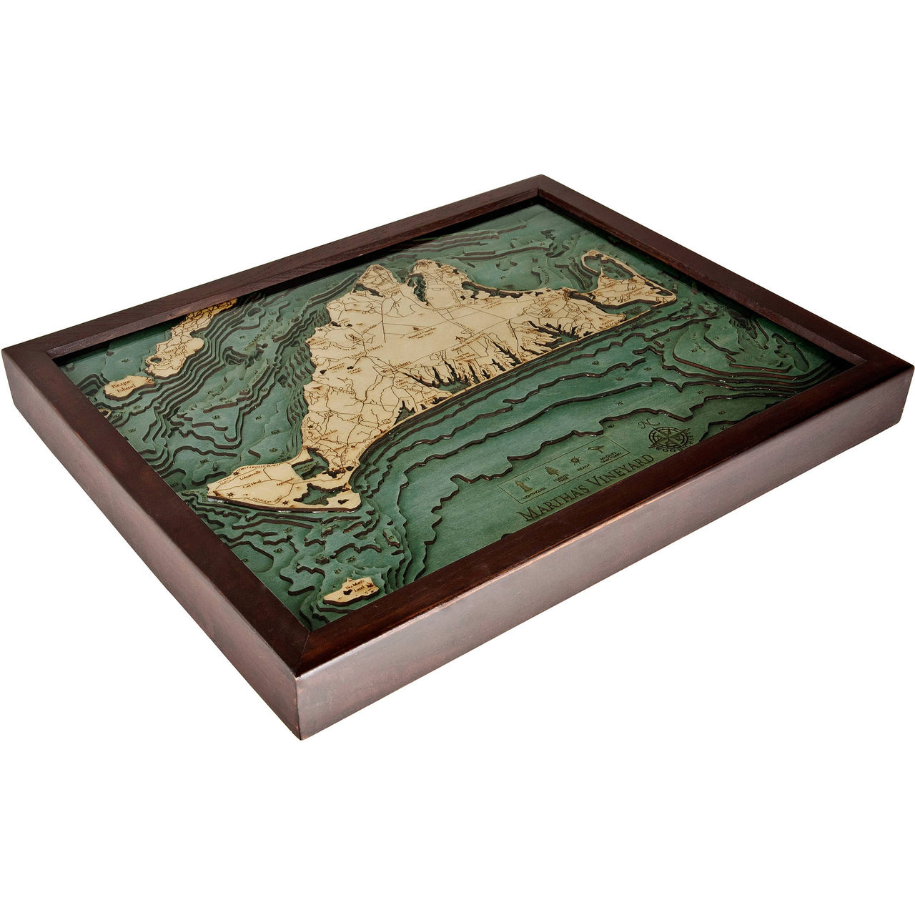
Martha's Vineyard
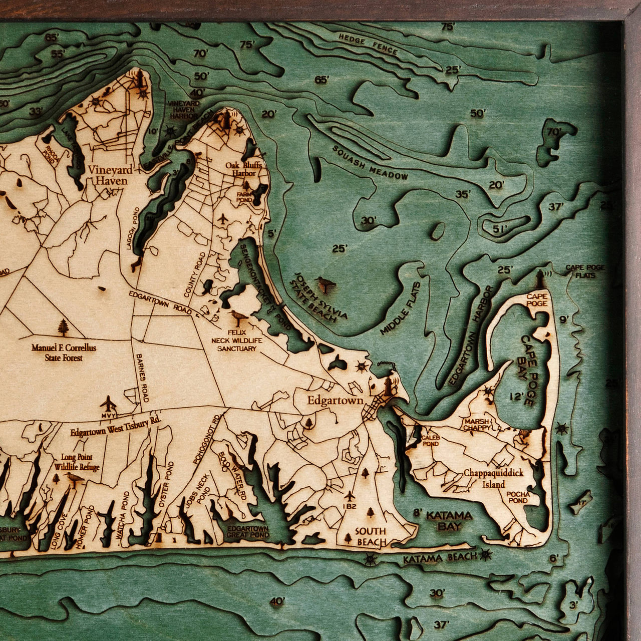
Often referred to simply “the Vineyard,” this highly sought-after summer colony is an island located in Massachusetts just south of Cape Cod. The much smaller Chappaquiddick Island is typically connected to the Vineyard though hurricanes and rough storms have separated the two in the past. The Elizabeth Islands and the island of Nomans Land are just two of the islands within the area that constitute the bulk of Duke County, Massachusetts. Of the 16,535 residents that reside in Martha’s Vineyard year-round, about 56 percent of the homes in the area are only occupied seasonally, as the population in the summer months have been known to swell to over 100,00 people. Because the island is only accessible by air or by boat, the cost of living skyrocketed to over 60 percent above the national average, with housing prices an astounding 96 percent higher than the average. The area has grown primarily as one of the most prominent summering havens where most of the social activities take place at people’s homes and not within the smaller, quiet town. This pleasant summer tourist destination is best known as a place of relaxation and celebrity regulars.
- Aquinnah
- Barnes Road
- Black Point Pond
- Bold Water Rd.
- Caleb Pond
- Cape Poge
- Cape Poge Bay
- Cape Poge Flats
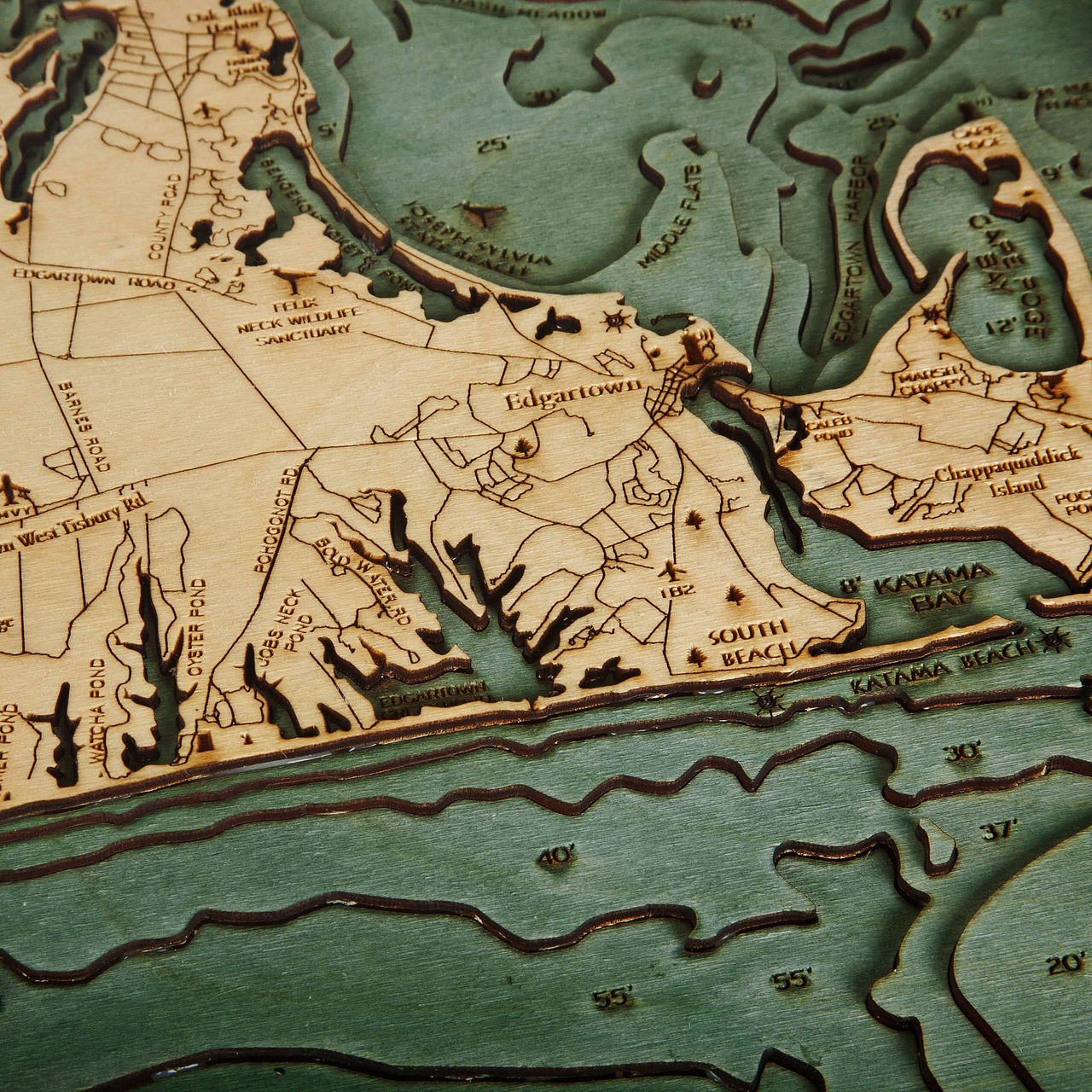
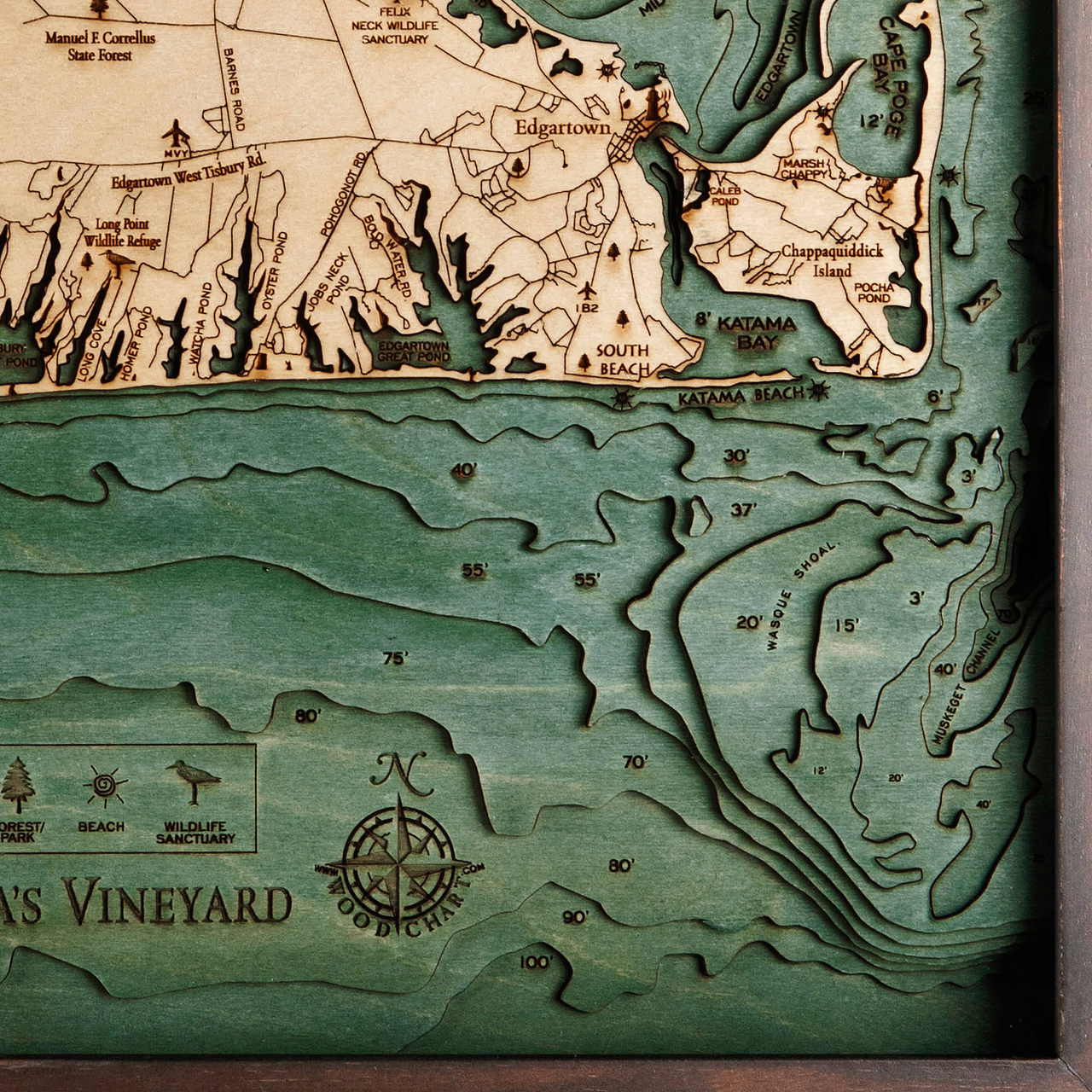
- Chappaquiddick Island
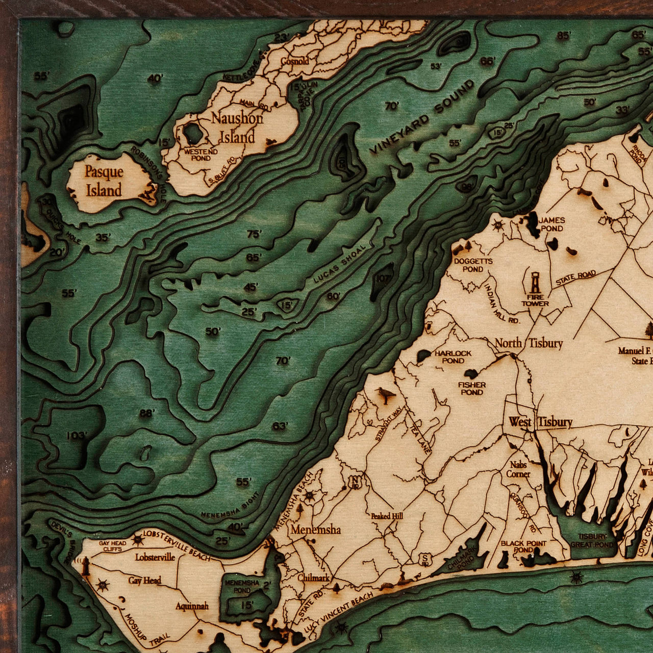
- Chillmark Pond
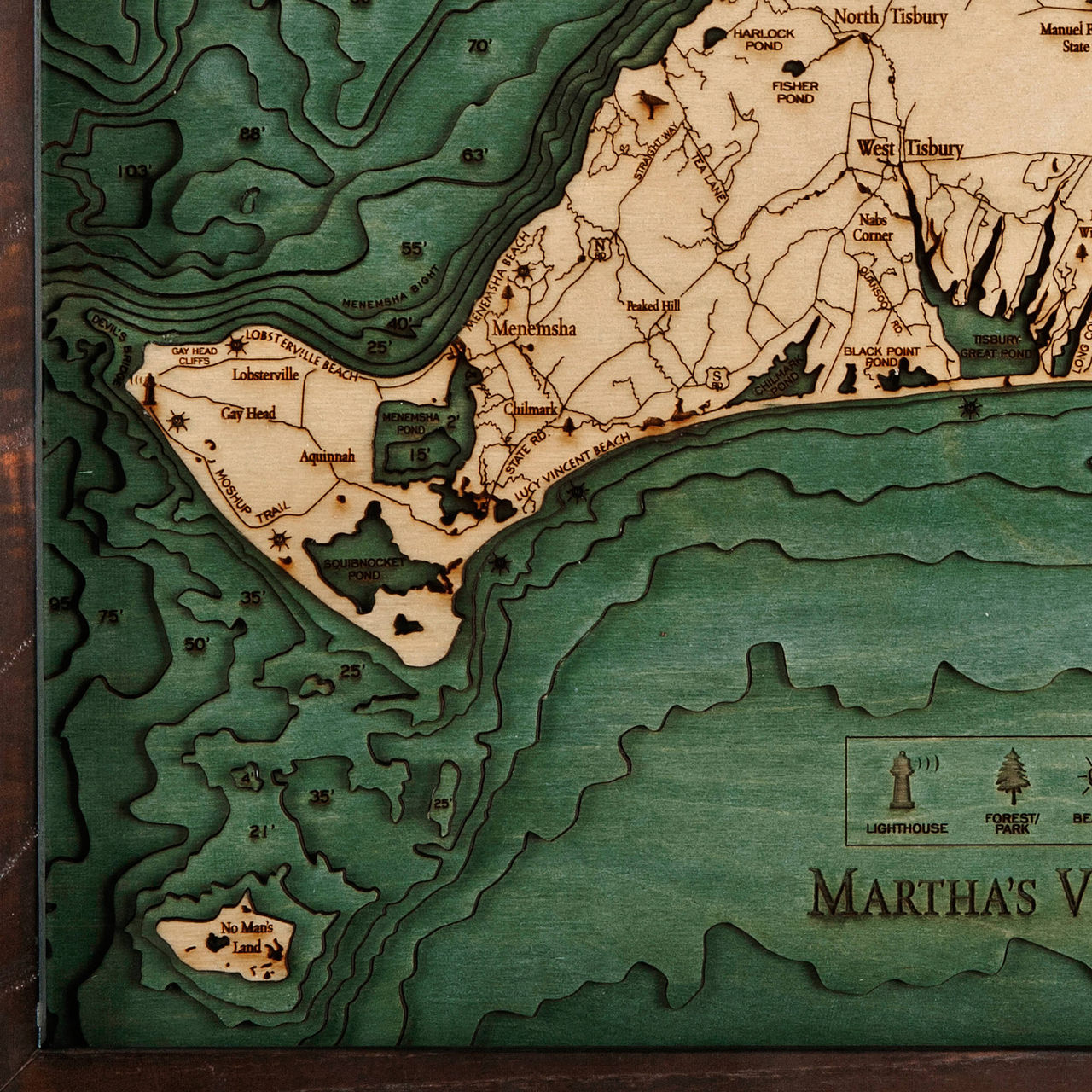
- Chilmark
- County Road
- Devil’s Bridge
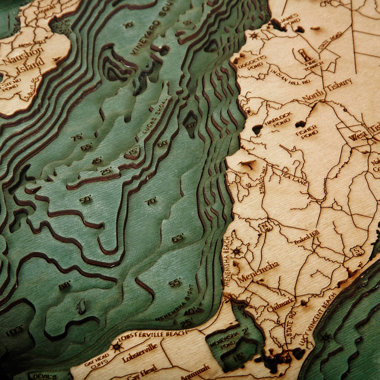
- Doggetts Pond
- Eastville Point Beach
- Edgartown
- Edgartown Great Pond
- Edgartown Harbor
- Edgartown Road
- Edgartown West Tisbury Rd.
- Farm Pond
- Felix Neck Wildlife Sanctuary
- Fire Tower
- Fisher Pond
- Gay Head
- Gay Head Cliffs
- Gosnold
- Harlock Pond
- Hedge Fence
- Homer Pond
- Indian Hill Rd.
- James Pond
- Jobs Neck Pond
- Joseph Sylvia State Beach
- Katama Bay
- Katama Beach
- Kettle Cove
- Laberts Cove
- Lake Tashmoo
- Lobsterville
- Lobsterville Beach
- Long Cove
- Long Point Wildlife Refuge
- Lucas Shoal
- Lucy Vincent Beach
- Main Rd.
- Manuel F. Correllus State Forest
- Marsh Chappy
- Menemsha
- Menemsha Beach
- Menemsha Bight
- Menemsha Pond
- Middle Flats
- Moshup Trail
- Muskeget Channel
- MVY
- Nabs Corner
- Naushon Island
- No Man’s Land
- North Tisbury
- Oak Bluffs Harbor
- Oyster Pond
- Pasque Island
- Peaked Hill
- Pocha Pond
- Pohogonot Rd.
- Quansoo Rd.
- Quicks Hole
- Rhoda Pond
- Robinson’s Hole
- Sengekontacket Pond
- South Bluff Rd.
- South Beach
- Squash Meadow
- Squibnocket Pond
- State Rd.
- State Road
- Straight Way
- Tarpaulin Cove
- Tea Lane
- Tisbury Great Pond
- Vineyard Haven
- Vineyard Haven Harbor
- Vineyard Sound
- Wasque Shoal
- Watcha Pond
- West Tisbury
- Westend Pond


