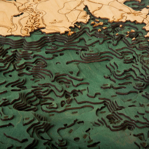
Moosehead Lake
The largest mountain lake in the United States eastern region is Moosehead Lake, which sits along the Longfellow Mountains in the Highland Region of Maine and is the primary source of the Kennebec River. The bordering towns include those of Greenville and Rockwood and the lake itself includes over 80 islands with Sugar Island being the largest among them all. Moosehead Lake has over 400 miles of shoreline with the Moose River being its primary inlet, flowing onward through Long Pond, Brassua, and the Roach River, with the Lake’s main outlet being the Kennebec River. This body of water is drained by major stem rivers that are included throughout a 330 mile span. With a landscape that covers 74,890 acres, it is one of the United States’ largest freshwater lakes.
- 13ME Airport
- 3B1 Airport
- Baker Brook Cove
- Baker Brook Point
- Barrows Cove
- Beaver Brook
- Beaver Cove
- Beaver Creek
- Big Dry Point
- Big Duck Cove
- Big Duck Pond
- Big Moose Pond
- Bigney Cove
- Birch Island
- Birch Point
- Black Point Road
- Bolton Cove
- Boulder Island
- Buck Lane
- Burgess Brook
- Burnham Pond
- Burnt Jacket Point
- Burnt Jacket Road
- Camp Road
- Caribou Point
- Carry Brook
- Case Point
- Center Island
- Cowan Brook
- Cowan Cove
- Cowan Point
- Cranberry Pond
- Deep Cove
- Deer Island
- Dollar Island
- Doughnut Cove
- Duggy Road
- Dyer Road
- E Road
- Eagle Stream
- East Outlet
- Farm Brook
- Farm Island
- Fox Island
- Galusha Cove
- Green Island
- Greenville
- Greenville Junction
- Hardscrabble Point
- Harford Point Road
- Harfords Point
- Harris Cove
- Hogback Island
- Hyde Island
- Ira Bog
- Jewett Cove
- Kennebec River
- Laker Point
- Lambs Cove
- Ledge Island
- Lily Bay
- Lily Bay Road
- Lily Bay Road
- Lily Bay State Park
- Little Baker Brook
- Little Duck Cove
- Little Duck Pond
- Little Moose Pond
- Little Mud Pond
- Long Brook
- Long Pond
- Lower Wilson Road
- Lucky Brook
- Lucky Point
- Lucky Pond
- Maine
- Mansell Brook
- Masterman Island
- Matthews Cove
- Maynard Road
- McCuller Island
- Mill Brook
- Moose Bay
- Moose Brook
- Moose Brook
- Moose Brook Islands
- Moose Island
- Moose Point
- Moose River
- Moosehead Lake
- Moosehead Lake Road
- Mountain View Pond
- Mud Cove
- Mud Pond Brook
- N Road
- NE Carry Cove
- Norcross Brook
- Norcross Point
- North Bay
- North Ridge Road
- North Road
- Northeast Cove
- Northern Road
- Northwest Cove
- Notch Pond
- Papoose Pond
- Pine Island
- Prong Pond
- Prong Pond Mountain
- Rineo Cove
- Rockwood
- Rockwood Road
- Ronco Brook
- Ronco Cove
- Ross Farm Road
- Rowell Cove
- Rum Brook
- Rum Cove
- Rum Pond
- Rum Ridge Road
- S Road
- Salmon Island
- Salmon Pond
- Sand Bar Island
- Sand Bar Point
- Sandy Bay
- Sawyer Pond
- Scammon Road
- Seboomook Island
- Seboomook Point
- Secret Pond
- Shadow Pond
- Ship Island
- Sibley Island
- Ski Resort Road
- Snake Island
- Socatean Bay
- Socatean Point
- Socatean Stream
- Somerset Road
- South Cove
- Spencer Bay
- Spencer Pond
- Spencer Stream
- Spinney Island
- Steven's Point
- Sugar Island
- The Narrows
- Toe of the Boot
- Toe of the Boot Road
- Togue Island
- Tom Young Pond
- Tomhegan Cove
- Tomhegan Point
- Trumbles Rock
- Twomile Island
- Upper Wilson Pond
- Varney Road
- Vaugh Stream
- West Cove
- West Cove Point
- West Outlet
- Williams Brook
- Williams Brook Road


