


Outer Banks
The string of barrier islands that split off the coast of North Carolina and southern Virginia are the 200-mile-long Outer Banks. Covering most of North Carolina’s coastline, the banks separate the Atlantic Ocean from Currituck Sound, Albemarle Sound, and Pamlico Sound. The subtropical climate and amazingly wide expanse of open beachfront make the Outer Banks a very desirable tourist destination, especially with the campgrounds of the Cape Hatteras National Seashore and its reputation as the Graveyard of the Atlantic due to the treacherous seas that caused an immense number of shipwrecks. The surrounding string of peninsulas and barrier islands in the area include Bodie Island, Hatteras Island, Ocracoke Island, Portsmouth Island, and Core Banks. The shifting sands and the dynamic process of beach evolution due to violent storms causes the older inlets to close and newer inlets open; because of this, the total number of islands and inlets is difficult to pinpoint. The Outer Banks also stretch to Sandbridge in the southward region of Virginia Beach.
- Austin Reef
- Bald Point
- Baum Point
- Bird Islands
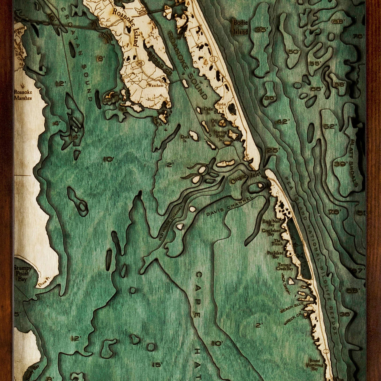
- Bodie Island
- Bodie Lt.
- Brigand Bay
- Broad Cr.
- Brooks Point
- Buxton
- Buxton Woods
- Buzzard Bay
- Canadian Hole
- Cape Channel
- Cape Hatteras
- Cape Hatteras Lighthouse
- Cape Hatteras National Seashore
- Cedar Bush Bay
- Cedar Island
- Cedar Island
- Chicamacomico Channel
- Clam Shoal
- Clarks Bay
- Colington Cr.
- Croatan Sound
- Currituck Banks Peninsula
- Davis Channel
- Diamond Shoals
- Drain Point
- Duck Island
- Eagle Nest Bay
- Eagleton Point
- Fort Raleigh City
- Frisco
- Frisco Pier
- Goat Island Bay
- Great Island
- Gull Island
- Gull Island Bay
- Hatteras
- Hatteras Bight
- Hatteras Inlet
- Hatteras Island
- Herring Shoal Island
- Hog Island
- HSE
- Jack Shoal
- Jean Guite Cr.
- Jockey’s Ridge
- Kill Devil Hills
- Kitty Hawk
- Kitty Hawk Bay
- Log Shoal
- Long Point
- Long Shoal
- Mann Point
- Manteo
- Midgett Cove
- MQU
- Nags Head
- No Ache Island
- North Atlantic Ocean
- Off Island
- Old House Channel
- Oliver Reef
- Oregon Inlet
- Pamlico Sound
- Pea Island Bay
- Pea Island National Wildlife Refuge
- Peters Ditch
- Platt Shoals
- Point Marina
- Roanoke Island
- Roanoke Marshes
- Roanoke Sound
- Rollinson Channel
- Round Hammock Bay
- Salvo
- Sandy Bay
- Sandy Bay
- Shallowbag Bay
- Shark Shoal
- Sloop Island
- Southern Shores
- Stumpy Point Bay
- Terrapin Creek Bay
- The Trench
- Wanchese
- Waves
- Weir Point
- Wimble Shoal
- Wreck Cr.
- Wright Bros. Memorial


