


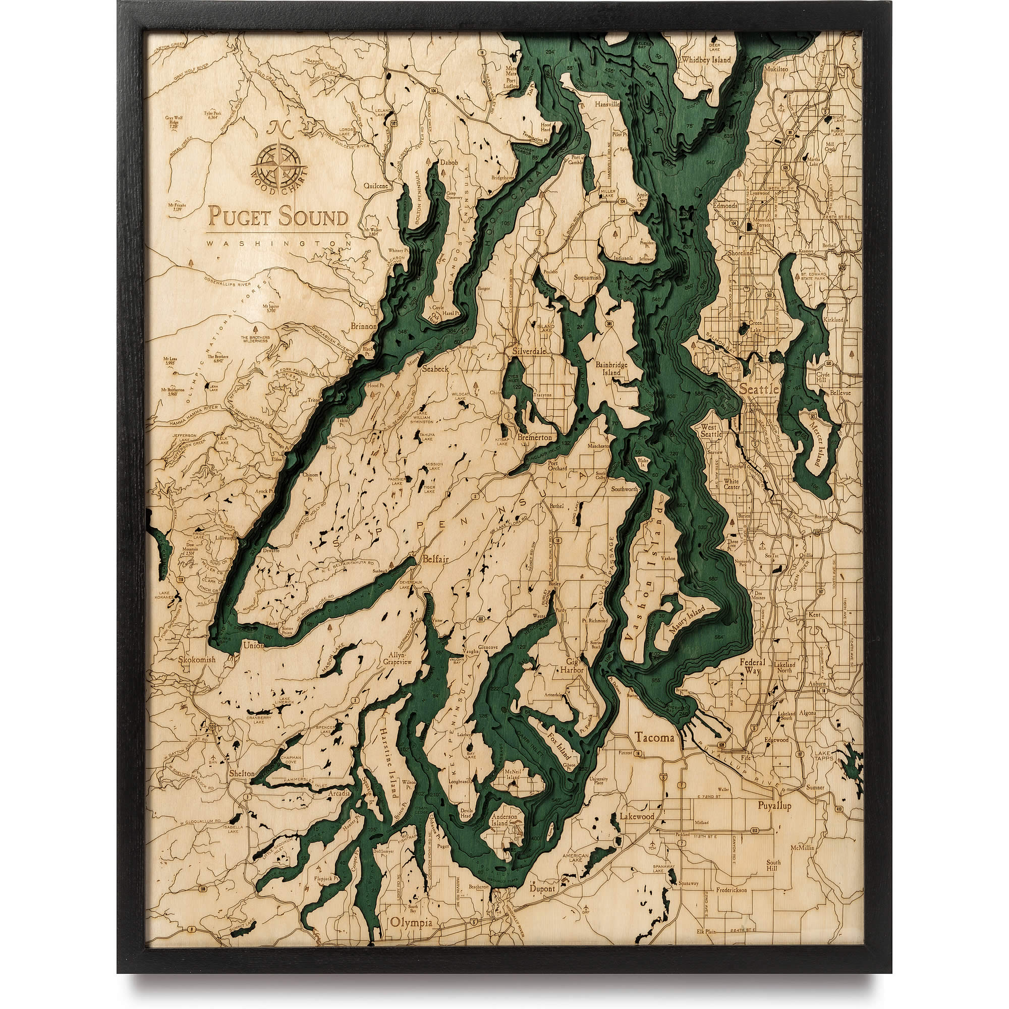
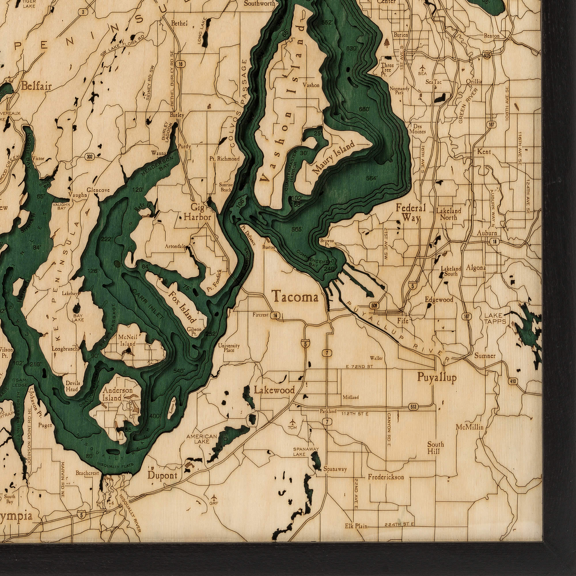
Puget Sound
With its impressive 100 miles in length and averaging 450 feet deep, The Puget Sound is recognized as the second biggest estuary in the United States (just behind Chesapeake Bay). The Puget Sound Region includes five major US cities: Seattle, Olympia, Edmonds, Tacoma, and Everett. Along with the Strait of Juan de Fuca and the Strait of Georgia, it is one of the major bodies of water in the Salish Sea. Both people and cars can easily move about the region using the unique state-run Washington Ferry system.
- American Lake
- Anderson Island
- Annas Bay
- Appletree Cove
- Arcadia
- Bainbridge Island
- Bay Lake
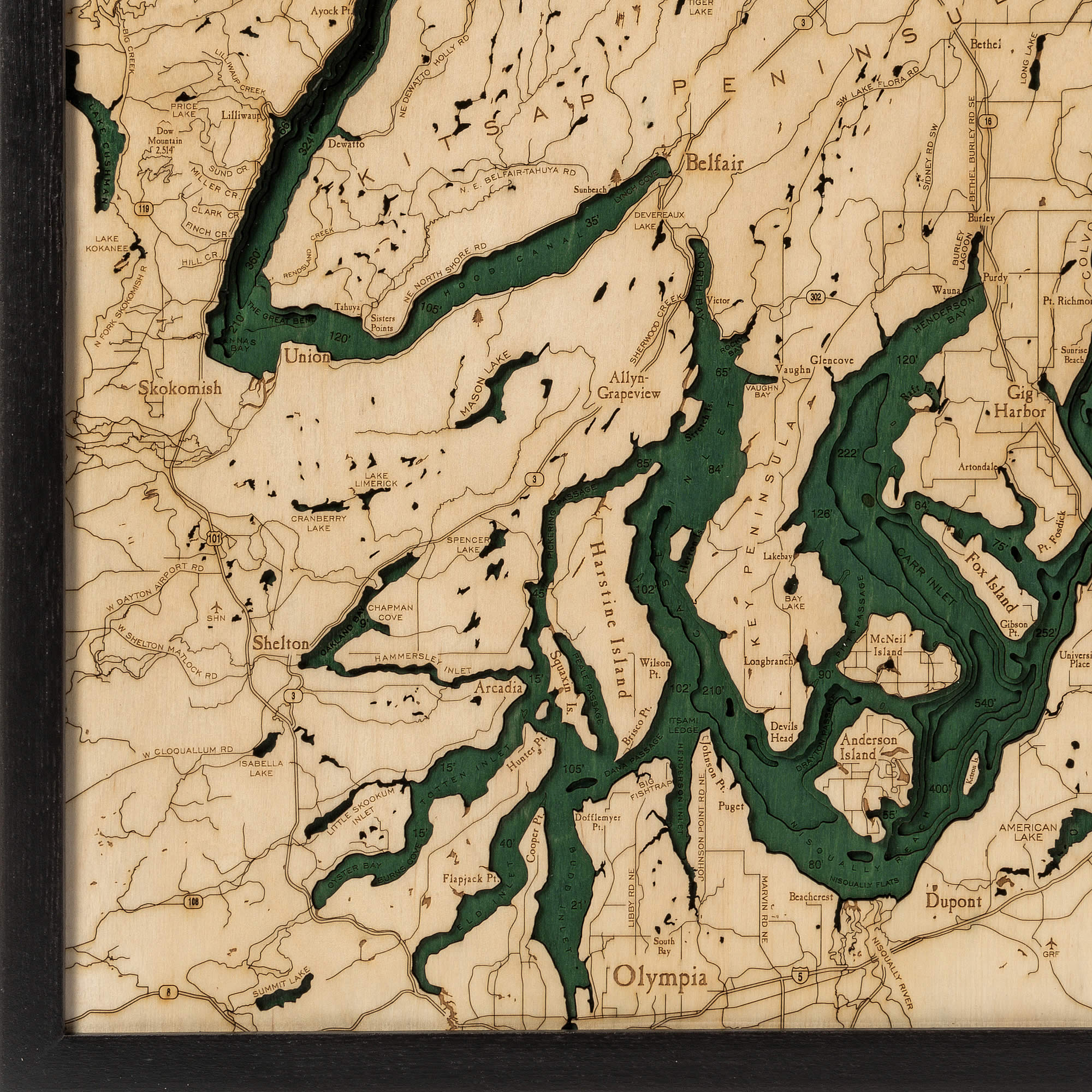
- Belfair
- Belfair State Park
- Bellevue
- Bermerton
- Big Creek
- Bit Fishtrap
- Blake Island
- Blakely Harbor
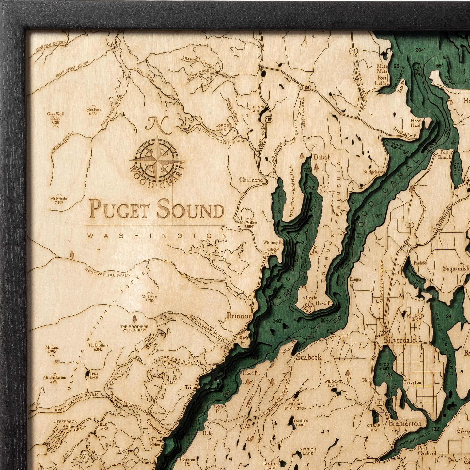
- Bolton Peninsula
- Browns Point Lighthouse
- Budd Inlet
- Burley Lagoon
- Carr Inlet
- Case Inlet
- Chapman Cove
- Chico Bay
- Clark Cr.
- Colvos Passage
- Dabob Bay
- Deer Lake
- Des Moines
- Devereaux Lake
- Devils Head
- Dewatto Bay
- Duckabush River
- Dyes Inlet
- Eagle Harbor
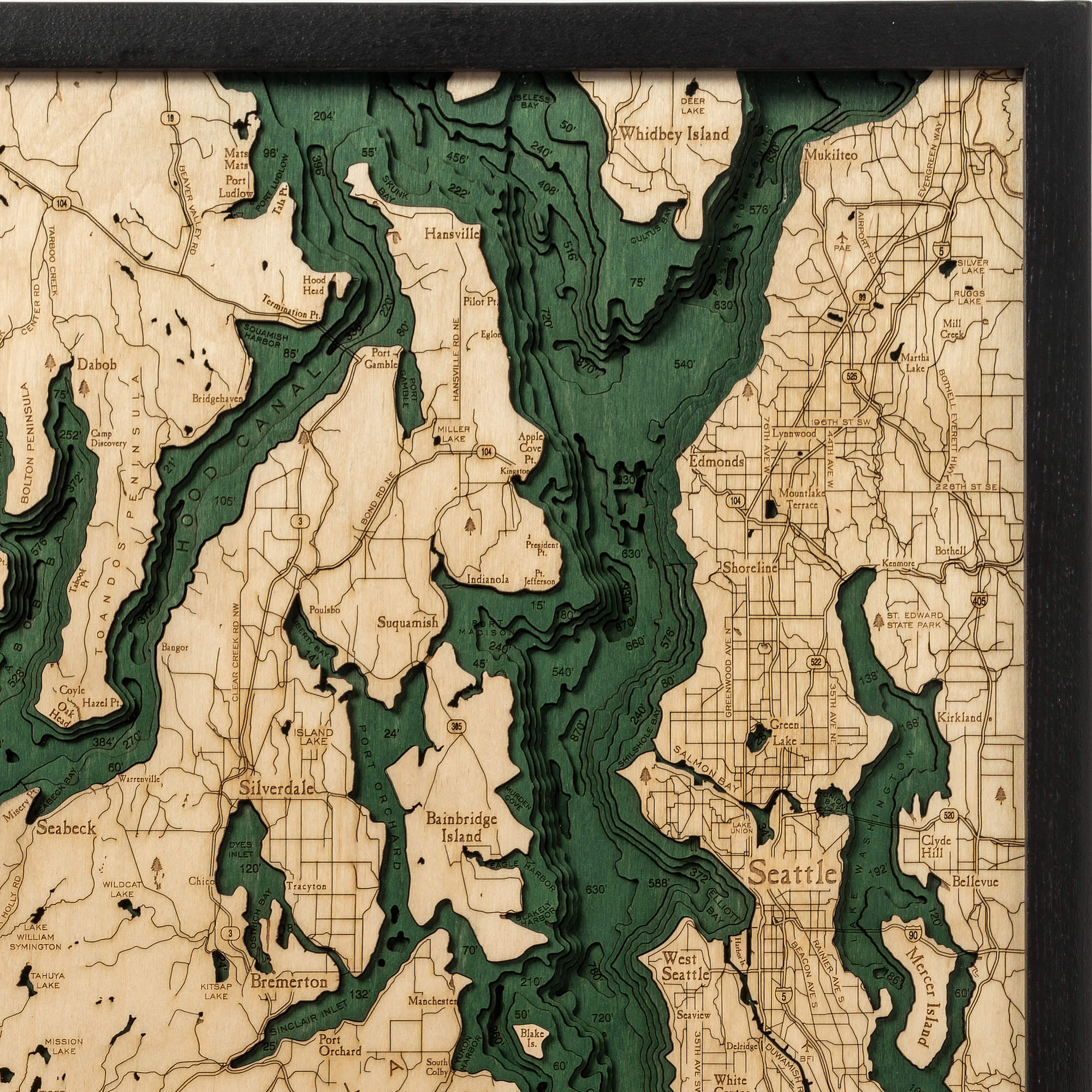
- Edmonds
- Eld Inlet
- Elliott Bay
- Federal Way
- Finch Cr.
- Fox Island
- Fulton Cr.
- Gibson Point
- Gig Harbor
- Glen Cove
- Grapeview
- Green Lake
- Green River
- Hamma Hamma River
- Hansvill
- Harbor Island
- Harstine Island
- Henderson Bay
- Henderson Inlet
- Herron
- Hill Cr.
- Holly
- Hood Canal
- Hood Canal Bridge
- Isabella Lake
- Island Lake
- Jackson Cove
- Ketron
- Key Peninsula
- Kingston
- Kirkland
- Kitsap Lake
- Kitsap Peninsula
- Lake Cushman
- Lake Kokanee
- Lake Tapps
- Lake Union
- Lake Washington
- Lakewood
- Liberty Bay
- Lilliwaup
- Lilliwaup Creek
- Little Skookum Inlet
- Lynch Cove
- Manchester
- Martha Lake
- Mason Lake
- Maury Island
- McNiel Island
- Mercer island
- Mill Creek
- Miller Bay
- Miller Cr.
- Miller Lake
- Mission Lake
- Mt. Skokomish Wilderness
- Mt. Walker Viewpoint
- Mukilteo
- Murden Cove
- N.West Seabeck Holly Rd.
- NE Belfair Tahuya Rd.
- Ne Dewatto Holly Rd.
- Nisqually Flats
- Nisqually River
- Olympia
- Olympic National Park
- Oro Bay
- Ostrich Bay
- Panther Lake
- Point Defiance
- Point Fosdick
- Point Jefferson
- Point Richmond
- Point Southworth
- Port Gamble
- Port Ludlow
- Port Madison
- Port Orchard
- Port Orchard Bay
- Possession Sound
- Poulsbo
- Poverty Bay
- President Point
- Price Lake
- Puyallup
- Puyallup Rive
- Quartermaster Harbor
- Quilcene Bay
- Raft Island
- Rendsland Creek
- Rocky Bay
- Saint Edward State Park
- Salmon Bay
- Seabeck
- Seattle
- Seaview
- Seward Park
- Shelton
- Sherwood Creek
- Shoreling
- Silver Lake
- Sinclair Inlet
- Sisters Point
- Siverdale
- Skokomish
- Skokomish River
- Skunk Bay
- Spanaway Lake
- Spencer Lake
- Squamish Harbor
- Squaxin Island
- Stretch Point
- Summit Lake
- Sund Cr.
- Suquamish
- Tacoma
- Tahuya Lake
- The Brothers Wilderness
- Three Tree Point
- Tiger Lake
- Toandos Peninsula
- Totten Inlet
- Union
- Union Bay
- Useless Bay
- Vashon Highway
- Vashon Island
- Vaughn Bay
- Whidbey Island
- White Center
- Whiteman Cove
- Wildcat Lake
- William Symington Lake
- Wonder Mountain Wilderness
- Yukon Harbor


