Sebago Lake
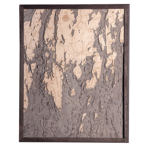
Located in the US state of Maine, Sebago Lake is as deep as 316 feet and reaches out to 45 square miles in surface area, making it the deepest and second largest lake in the country. The neighboring towns include Casco, Naples, Raymond, Sebago, Standish, Windham, and there is the small island town of Frye Island that is found in the lake itself and is generally just seasonally occupied. Brandy Pond connects the lake to the Songo River, which leads to Long Lake in Naples and is primarily drained by the Presumpscot River. Sebago Lake by name comes from the area's local Native American tribe and served as a source of coastal transportation to the interior areas for the Europeans, which aided in their settlement of Maine in the 1760s. Linked to the Portland harbor, the lake made this waterway connection via the Cumberland and Oxford Canal.
- Adams Pond
- Al Rd.
- Anderson Rd.
- Bachelder Brook
- Back Cove
- Barstow Rd.
- Battleship Island
- Bear Point
- Birch Island
- Boundary Rd.
- Browns Point
- Burke Rd.
- Burnell Cove
- Camp Cove
- Cape Rd.
- Chadbourne Rd.
- Chub Pond
- Cole Hill Rd.
- Cub Cove
- Deep Cove Rd.
- Dingley Brook
- Doctor Island
- Duck Pond
- Dundee Pond
- East Sebago
- Eel Weir Canal
- Fire Lane 25
- Fitch Mill Pond
- Flag Cove
- Folly Rd.
- Forest Rd.
- Fort Hill Rd.
- Frye Island
- Fryes Leap
- Gore Rd.
- Great Bay Rd.
- Half Moon Pond
- Harbor Rd.
- Harmon Beach
- Harmons Beach Rd.
- Hawkes Rd.
- Hearthside Dr.
- High Point Dr.
- Highland Rd.
- Hurricane Rd.
- Hyde Brook
- Indian Island
- Inner Green Island
- Inner Island
- Jones Point Rd.
- Jordan Bay
- Kettle Cove
- Kimball Corner Rd.
- Lake Wood Rd.
- Leavitt Brook
- Leisure Lane
- Libby Rd.
- Lindsay Island
- Little Watchie Pond
- Littlefield Rd.
- Lower Bay
- Lower Harvey Cove
- Maple Cove
- Meadow Rd.
- Middle Jam Rd.
- Middle Rd.
- Mill St.
- Millstone Island
- Mineral Spring Rd.
- Moody Rd.
- Musson Rd.
- Nason Brook
- New Place Cove
- North Gorham Pond
- North Gorham Rd.
- North Sebago
- North Windham
- Nothwest River
- Oak Hill Rd.
- Other Ponds
- Outer Birch Island
- Outer Green Island
- Outer Island
- Outlet Brook
- Panther Pond
- Papoose Island
- Park Access Rd.
- Plains Rd.
- Point Sebago Way
- Pond Rd.
- Pre Sumpscot River
- Presumpscot River
- Quaker Ridge Rd.
- Quarry Cove Rd.
- Raymond
- Raymond Cape
- Rich Millpond
- Richville
- Richville Rd.
- Ridge Rd.
- Ring Island
- River Rd.
- Roosevelt Trail
- Schooner Cove
- Sebago Cove
- Sebago Haven
- Sebago Lake
- Sebago Lake Basin
- Sebago Lake Rd.
- Sebago Lake State Park
- Sebago Rd.
- Shaw Rd.
- Sheep Island
- Shingle Cove
- Sloanes Cove
- Smith Mill Rd.
- Snake Pond
- Songo Lock
- Songo River
- Songo School Rd.
- South Casco
- South Naples
- Spider Island
- Squaw Island
- Standish Neck Rd.
- State Camping Rd.
- State Park Rd.
- Steep Falls Wildlife Management Area
- Sticky River
- Strout Brook
- The Notch
- Thomas Pond
- Thomas Pond Terrace Rd.
- Thompson Point Rd.
- Trickey Pond
- Trickey Pond Rd.
- Tucker Brook
- Turtle Cove
- Upper Harvey Cove
- Wards Cove
- Webbs Mills Rd.
- Whites Bridge Rd.
- Whitney Brook
- Wilson Rd.
- Witch Cove


